
Walk a La Porte Street Directory
Address work in La Porte starts with a current parcel record and becomes stronger as it moves through independent sources. Harris Central Appraisal District, known as HCAD, can connect a street number to the current tax owner, situs address, mailing address, account, and legal description. The Harris County Clerk index can then connect that legal description to a recorded instrument. A historic directory may supply a past householder, while the voter search can only help confirm a limited registration match. None of those sources is a complete household list.
- Search the address or a street range in HCAD Advanced Real Property Search. Save the account number and legal description exactly as displayed.
- Use the HCAD Parcel Viewer to place the result on the block and open neighboring parcel links. Treat geometry as map context, not a legal survey.
- Compare the owner, situs address, and mailing address. A mailing address can belong to an owner who does not occupy the parcel.
- Search the owner as grantee in the Harris County Clerk Real Property Search, then use the grantor as an earlier grantee for the same legal description.
- For a past household, use the street sections in La Porte directory volumes and then check the alphabetical entry or local newspaper evidence.
That order keeps the La Porte address trail grounded in address-keyed records. It also prevents a common mistake: treating a tax owner, a deed signer, a permit applicant, and a resident as if they were always the same person.
Search La Porte Street Ranges
HCAD is the practical first pass for a La Porte address search because it accepts a property street name, beginning and ending street numbers, ZIP Code, owner name, legal description, and several map or building fields. Street-name results use a “SIMILAR Street Name” criterion. HCAD says partial street text can help, capitalization does not matter, and its “Values on Same Street” links can expose nearby accounts. Its data is usually refreshed nightly, while downloadable property data describes annual coverage from 2005 through 2026.
| HCAD field | Entry type | How it helps a street search |
|---|---|---|
| Property Street Name | Text with similar-name criterion | Find a named La Porte street, including partial text. |
| Beginning and Ending Property Street Number | Text or number | Reduce a long street to an address range. |
| ZIP Code | Five digits | Narrow parcel results within postal geography. |
| Owner Name | Last name first, partial accepted | Return to a known tax owner after an address result. |
| Legal Description | Partial text | Bridge a parcel to a deed when street data fails. |
| Tax Year, Key Map, or Map Facet | Portal controls | Refine a large result set or map location. |
HCAD does not work like a general map search. A parcel can have no street number, a missing mapped address, or a mailing address that looks like the property address. Use the results as a researched starting point, not a claim that every person connected to a La Porte address lives there.
A HCAD address-search help screen shows the controls used for this La Porte address workflow.
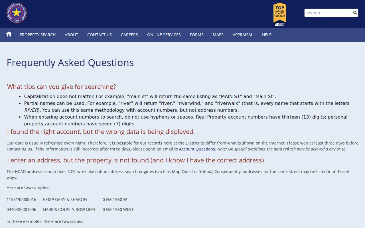
The search fields matter most when a street name returns many parcels, since a range and ZIP can narrow the list before a deed search begins.
Map a La Porte Street Parcel
The HCAD Parcel Viewer accepts a complete or partial address, account number, owner name, map click, and current-location controls. Select a result to highlight its polygon and open its popup or detail information. From there, owner and account links move back to HCAD fields. Adjacent polygons are useful for a close La Porte street search because each can be clicked in turn, then checked as its own parcel.
The viewer offers base-map, layer, zoom, pan, and result-selection controls. Its official help does not document a named buffer or radius tool, and it describes the parcel map as approximate rather than a legal survey. The City GIS pages provide zoning, flood, industrial, parks, street, and ZIP context, but those layers should not be used to prove ownership.
A La Porte city maps page supplies the local map context surrounding an address search.
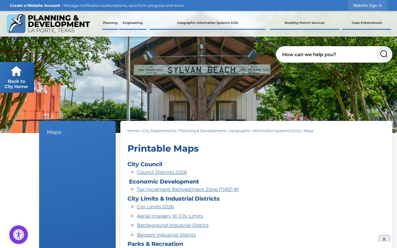
Use a city map to recognize a railroad, drainage route, city-limit line, or industrial area near a parcel. Return to HCAD and the Clerk for the address-linked record itself.
Note: Map labels help compare places, but parcel geometry and municipal layers do not replace a recorded plat or survey.
La Porte Street Records by Address
La Porte address research becomes more useful when the record type is matched to the question. HCAD covers current tax-parcel facts. The Clerk covers recorded property instruments. The City’s permit and code channels describe property activity, with different access routes. Historic street pages preserve earlier occupants and businesses. Voter information can help with a registration status or address-related match, but it withholds protected data and should not be treated as a block roster.
| Address record | La Porte or county keeper | Useful result | Access route |
|---|---|---|---|
| Current tax parcel | HCAD | Owner, mailing and situs addresses, legal description, account, values, and exemptions | Free web search and public data downloads |
| Parcel map | HCAD and City GIS | Parcel outline, nearby parcels, map facet, and boundaries | Free viewer, with approximate geometry |
| Recorded deed or plat | Harris County Clerk | Parties, instrument, recording date, legal description, and document references | Free index; images and copy routes have limits |
| Permit or inspection | La Porte Building Services | Project address, parcel, applicant or owner, use, area, and inspections | Citizen Self Service for current work |
| Code case | La Porte Code Enforcement | Address, parcel, violation, and any releasable status evidence | Public Information Act request route |
| Registration context | Harris County Tax Office | Limited current or pending registration match | Public lookup with protected fields withheld |
This division of labor is important in La Porte. City records sit with city departments, property instruments sit with Harris County, and a voter result is limited by Texas election-law protections. If a needed city code record is not online, use the Texas Public Information Act request path rather than assuming there is a public case screen.
Trace a La Porte Street Deed Chain
Recorded deeds provide the ownership history behind a La Porte address result. In the Clerk search, grantor, grantee, and trustee names are entered last name first without punctuation. Date ranges, file number, film code, subdivision, lot, block, unit, tract, reserve, volume, and page offer ways to narrow the record. Search the current owner as grantee, inspect the instrument for its legal description, then search the seller as grantee in an earlier date range. This backward grantor-to-grantee move is the core title-chain method.
Online property images generally begin November 1, 1960. New filings can take one to two business days to appear. Searching is free, but purchasing non-certified or certified copies needs an account and copies are sent by email. An online certified copy has no raised seal. For a raised-seal copy, difficult older record, or pre-image period, contact the Real Property Department or use its Copy Order Form; older books may require the County Clerk warehouse or a Harris County Archives appointment.
County historical holdings reach back to 1836, but the research did not establish the oldest online index year for every instrument type. A La Porte street result that stops online is a cue to use the office and archive routes, not evidence that the property has no earlier history.
Note: A subdivision, lot, block, abstract, or tract can identify the same parcel when an older deed does not match today’s street number.
La Porte Address Files Beyond Deeds
City permit records add a project layer to La Porte address research. Building Services moved planning and development applications and inspections to Citizen Self Service on June 18, 2024. Current material can associate a project with an address, HCAD parcel, applicant or owner, construction use or area, and inspections. Historic online coverage was not identified, so an absent portal result does not settle the question for an older property.
A La Porte Building Permit Services page shows the current channel for address-based project work.
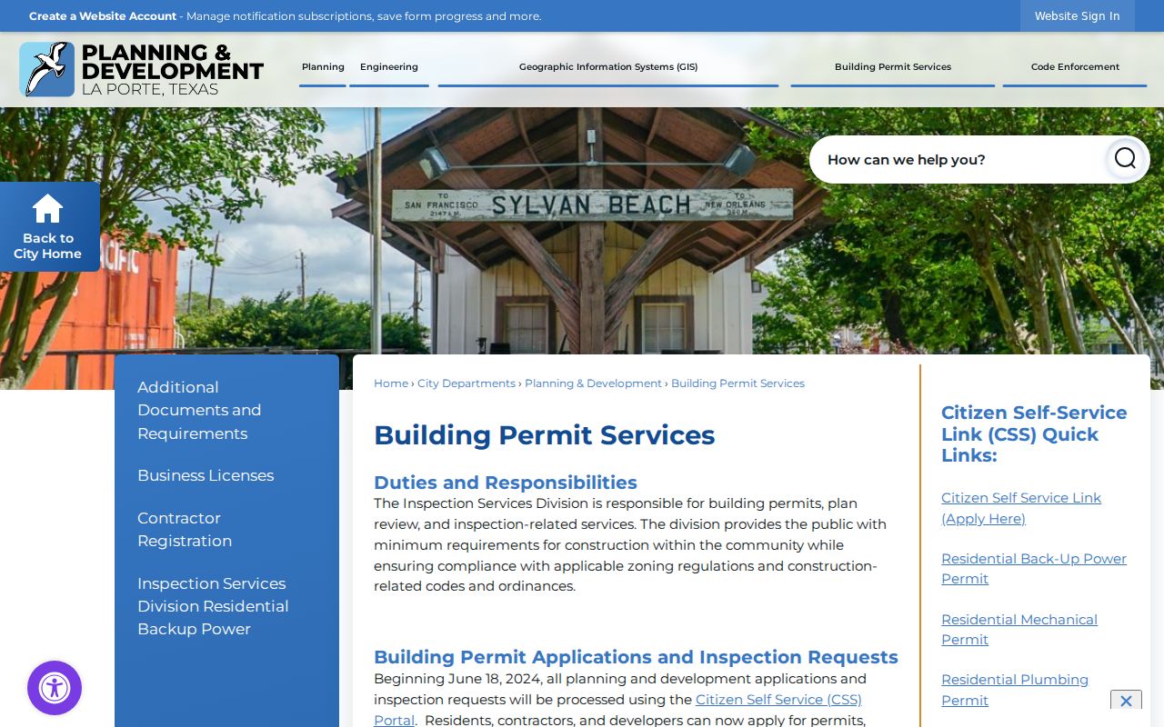
Permit material can place a project at an address, but it does not establish who occupies the property now.
For code matters, the City’s research record identifies a Public Information Act route and no public case lookup. The La Porte Code Enforcement page is the appropriate starting point for that department.
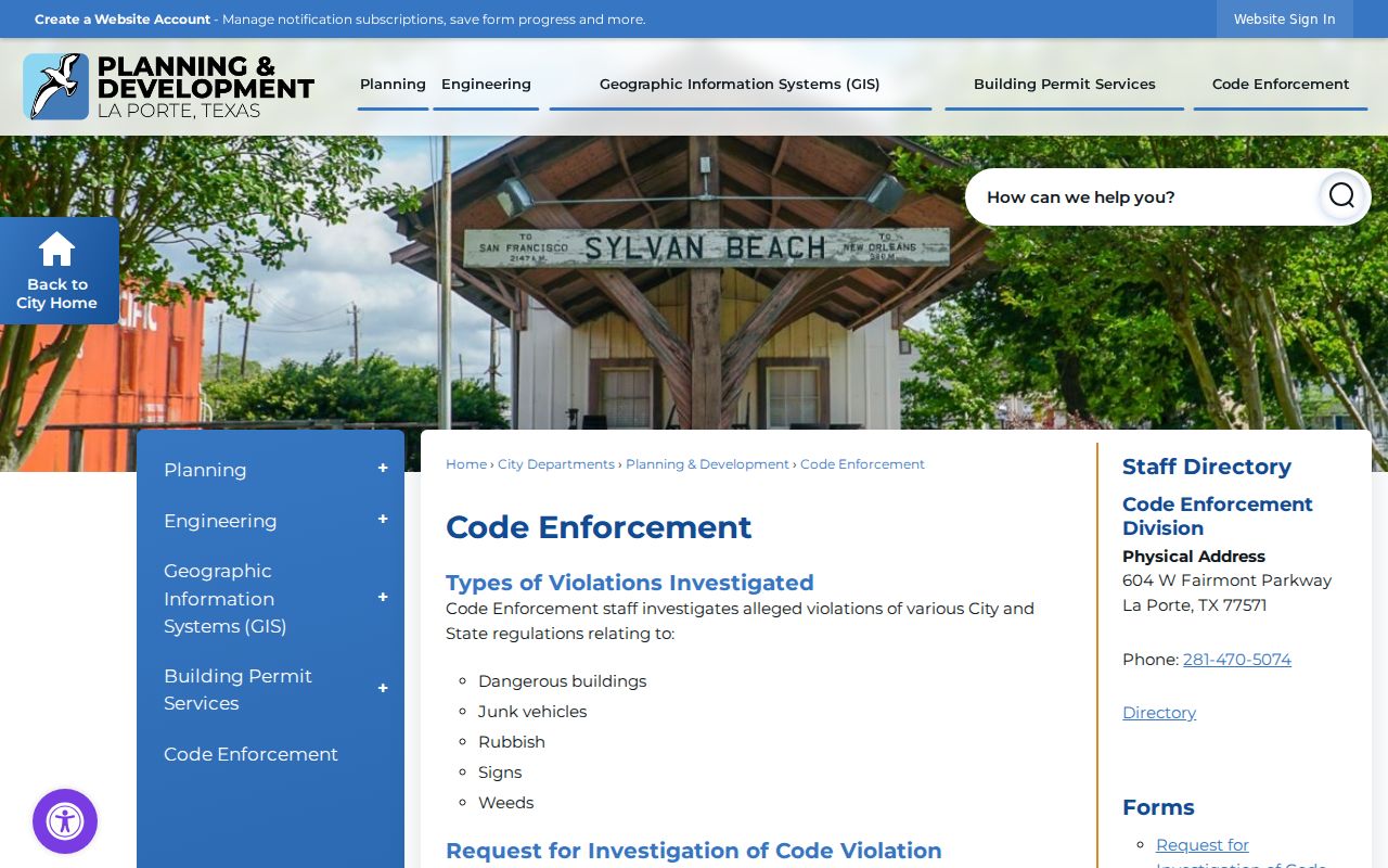
A code case can describe property context or a violation. It should not be read as proof that an applicant, reporter, contractor, or owner is the current resident.
La Porte Street Directory History
Historic street listings answer a past-address question that current parcel records cannot. The 1937 Tri-Cities directory includes a street and householders’ guide. Later La Porte-area directory runs include 1940–41, 1942, 1944, 1946, 1948, 1952–53, and 1960–61, with a La Porte and Seabrook entry at the Texas State Library for 1964. These volumes can show an address, phone, spouse or household details, and street or business sections, but they remain time-specific publisher records.
The most efficient historic street search starts in a directory’s street section, then checks the alphabetical entry. Copy the street spelling, city label, page, phone, spouse or household number, and the volume’s abbreviation key. For a person-centered confirmation after the historic address is identified, use the La Porte resident lookup rather than stretching a street source beyond its date.
The 1937 directory uses @3 for ownership and H for the Humble Oil & R Co exchange. The 1940–41 volume instead uses h/r and household counts. Preserve the key and page image with the entry, because abbreviations are not standardized across decades.
Read La Porte Street Descriptions
Street numbers change in usefulness from one record system to another. HCAD maps the physical property address, while County Clerk instruments rely on a legal description. La Porte history also includes Old Town, New Town, East La Porte, West La Porte, Lomax consolidation in 1980, and Bayshore MUD annexation in 1987. An older community label should be compared with subdivision and city-limit maps before it is rejected as unrelated.
- Parcel
- A defined property unit in the tax and map system, commonly tied to an HCAD account.
- Situs address
- The physical property location used for mapping, distinct from the owner’s tax-mailing address.
- Plat
- A recorded subdivision map that can connect lots, blocks, streets, easements, and parcel geometry.
- Criss-cross directory
- A reverse street listing that organizes historic entries by address instead of only by name.
Research did not find an official La Porte street-renumbering chronology. When an address fails, test the legal description, lot and block, a former spelling, a directory street list, and a newspaper address rather than inventing a renumbering rule.
La Porte Street Search Insider Tip
For a long La Porte street, an HCAD range plus ZIP filter is often faster than repeating a one-name search. Once the relevant range appears, use “Values on Same Street” and the Parcel Viewer’s adjacent polygons to compare nearby parcels one at a time. The method is especially useful when an owner name is common or the mailing address is outside La Porte.
Keep each account and legal description with its source date. A concise record trail makes it easier to see whether a result is a tax owner, a former owner, or a historic householder.
Note: HCAD’s public parcel data can support a careful address trail, but it does not identify all people who occupy a home.
Limits of a La Porte Street Directory
A La Porte street directory cannot supply a current roster of every household member. HCAD identifies a tax owner and mailing destination, not every occupant. A deed identifies parties to an instrument, not present residency. Directory street sections are historical snapshots. Permit applicants, owners, contractors, and code reporters may have a connection to the property without living there. DMV address records and utility customer lists are restricted and are not substitutes for public address research.
Texas Election Code §13.004 also keeps telephone numbers, Social Security numbers, driver-license or ID numbers, dates of birth, and protected residence addresses out of ordinary voter displays. Some protected participants may show a substitute or masked address. A no-result, mailing-address mismatch, or missing map point should never be treated as proof that someone did not live in La Porte.
Lawful use. Use La Porte address records for personal, lawful research and respect protected fields. Texas Penal Code §42.072 prohibits stalking and repeated conduct that causes fear or harassment.